A high-angle aerial drone shot tracking forward over the Old Mumbai-Pune Highway (NH 48) as it winds through the lush green landscape of the Panvel area. The video captures light traffic, including trucks and cars, moving along the road. The highway is surrounded by dense green forests, small villages, and agricultural fields, showcasing a scenic rural transportation route.


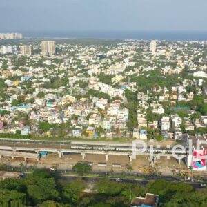 PD0880 - Aerial View of Chennai's Coastal Cityscape with Urban Art and Train
1 × ₹11,800.00
PD0880 - Aerial View of Chennai's Coastal Cityscape with Urban Art and Train
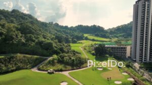
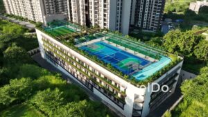
1 × ₹11,800.00  PD1014 - Top-Down Aerial Orbit of Rooftop Sports Courts and Golf Course
1 × ₹11,800.00
PD1014 - Top-Down Aerial Orbit of Rooftop Sports Courts and Golf Course
1 × ₹11,800.00 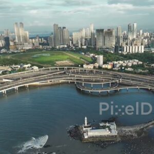 PD1129 - Aerial Drone Pan of Haji Ali Dargah, Coastal Road, and Mumbai Skyline
1 × ₹29,500.00
PD1129 - Aerial Drone Pan of Haji Ali Dargah, Coastal Road, and Mumbai Skyline
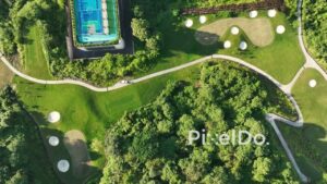
1 × ₹29,500.00  PD1009 - Aerial Orbit of Rooftop Sports Amenities on a Podium in a Luxury Golf Course Township
1 × ₹11,800.00
PD1009 - Aerial Orbit of Rooftop Sports Amenities on a Podium in a Luxury Golf Course Township
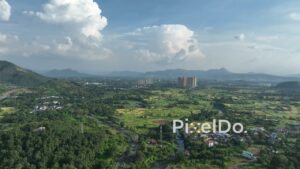
1 × ₹11,800.00  PD1012 - Aerial Orbit of Highway and Rural Village in Panvel Area
1 × ₹11,800.00
PD1012 - Aerial Orbit of Highway and Rural Village in Panvel Area
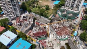
1 × ₹11,800.00 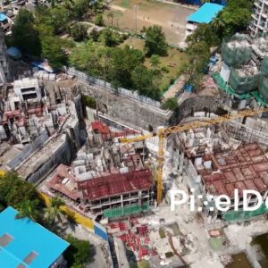 PD1007 - Aerial Orbit of a Large Urban Construction Site with Tower Crane
1 × ₹8,850.00
PD1007 - Aerial Orbit of a Large Urban Construction Site with Tower Crane
1 × ₹8,850.00 Subtotal: ₹85,550.00