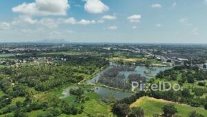
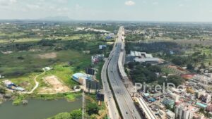
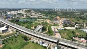
A stunning, wide aerial drone shot of the National Highway 44 (NH44), the main expressway connecting Hyderabad and Bangalore, as it passes through the city’s developing outskirts. The footage captures the modern, elevated highway with a steady flow of traffic, flanked by a large lake, a high-rise building under construction, and the sprawling urban landscape. This shot highlights the scale of modern Indian infrastructure and the vital role of national highways in the country’s economic growth.


 PD0972 - Aerial Drone Captures a Massive Flock of Birds Taking Flight
1 × ₹14,160.00
PD0972 - Aerial Drone Captures a Massive Flock of Birds Taking Flight
1 × ₹14,160.00  PD0016 - Aerial View of Traffic Bottleneck on BKC Flyover, Mumbai
1 × ₹17,700.00
PD0016 - Aerial View of Traffic Bottleneck on BKC Flyover, Mumbai
1 × ₹17,700.00 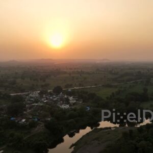 PD0625 - Golden Sunset Over a Rural Riverside Village
1 × ₹11,800.00
PD0625 - Golden Sunset Over a Rural Riverside Village
1 × ₹11,800.00 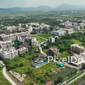 PD1057 - Aerial Drone Pan of Suburban Residential Township with Mountain Backdrop
1 × ₹8,850.00
PD1057 - Aerial Drone Pan of Suburban Residential Township with Mountain Backdrop
1 × ₹8,850.00  PD0813 - Aerial Shot of Farmers Loading Watermelon Harvest onto a Truck
1 × ₹14,160.00
PD0813 - Aerial Shot of Farmers Loading Watermelon Harvest onto a Truck
1 × ₹14,160.00 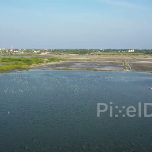 PD0975 - Orbiting Drone View of a Coastal Wetland and Bird Sanctuary
1 × ₹14,160.00
PD0975 - Orbiting Drone View of a Coastal Wetland and Bird Sanctuary
1 × ₹14,160.00 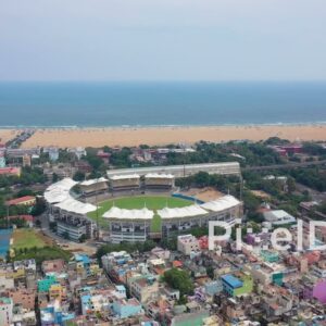 PD0860 - Aerial Flight Towards Chennai's M. A. Chidambaram Cricket Stadium
1 × ₹14,160.00
PD0860 - Aerial Flight Towards Chennai's M. A. Chidambaram Cricket Stadium
1 × ₹14,160.00 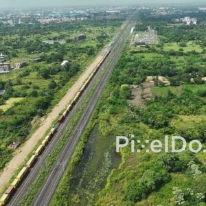 PD1061 - Aerial Drone Flight Over a Long Freight Train on a Suburban Corridor
1 × ₹14,160.00
PD1061 - Aerial Drone Flight Over a Long Freight Train on a Suburban Corridor
1 × ₹14,160.00  PD0633 - Sustainable Urban Planning: A Green Township in Pune
1 × ₹17,700.00
PD0633 - Sustainable Urban Planning: A Green Township in Pune
1 × ₹17,700.00 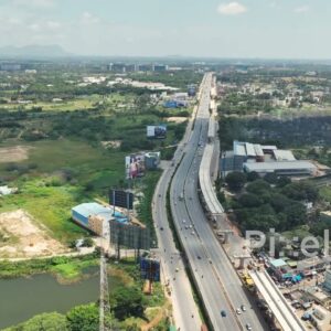 PD0170 - Aerial View of the Bangalore-Hyderabad Highway (NH 44)
1 × ₹14,160.00
PD0170 - Aerial View of the Bangalore-Hyderabad Highway (NH 44)
1 × ₹14,160.00 Subtotal: ₹141,010.00