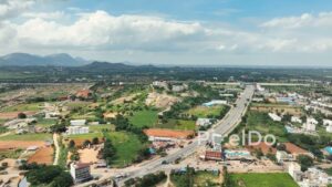
A cinematic aerial drone shot flying along India’s National Highway 44 (NH 44), the Bengaluru-Hyderabad highway, as it passes through the developing area of Devanahalli. The footage showcases the multi-lane expressway with steady traffic, flanked by a mix of traditional agricultural land, coconut groves, lakes, and new real estate developments. With the town of Devanahalli and the region’s characteristic rocky hills in the background, this shot captures the growth of a satellite town and the role of highways in India’s development.


 PD0909 - Aerial Flight Towards a Fishing Boat at Sunrise
1 × ₹14,160.00
PD0909 - Aerial Flight Towards a Fishing Boat at Sunrise
1 × ₹14,160.00  PD0341 - Aerial View of Babulnath Temple
1 × ₹14,160.00
PD0341 - Aerial View of Babulnath Temple
1 × ₹14,160.00  PD0652 - Aerial Top-Down View of Modern Geometric Garden and Landscape Architecture
1 × ₹5,900.00
PD0652 - Aerial Top-Down View of Modern Geometric Garden and Landscape Architecture
1 × ₹5,900.00  PD0168 - Aerial View of Chikkajala Lake with Bengaluru Cityscape and Metro Line
1 × ₹11,800.00
PD0168 - Aerial View of Chikkajala Lake with Bengaluru Cityscape and Metro Line
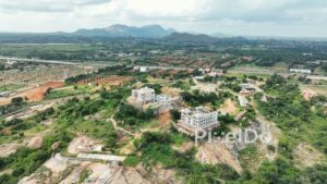
1 × ₹11,800.00 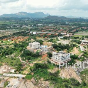 PD0154 - Aerial View of a Jain Temple and Developing Town near Bangalore
1 × ₹14,160.00
PD0154 - Aerial View of a Jain Temple and Developing Town near Bangalore
1 × ₹14,160.00 Subtotal: ₹60,180.00