A stunning top-down aerial shot of Mumbai’s Eastern Express Highway, capturing the bustling stretch between Powai and Mulund. The footage showcases the highway’s constant flow of traffic, which forms a stark boundary between two distinct ecosystems. On one side are the geometric, water-filled salt pans, and on the other, the dense, lush mangrove forests of the Thane Creek area, offering a unique perspective on Mumbai’s urban geography.


 PD1013 - Top-Down Aerial View of Luxury Golf Course and Rooftop Sports Courts
1 × ₹11,800.00
PD1013 - Top-Down Aerial View of Luxury Golf Course and Rooftop Sports Courts
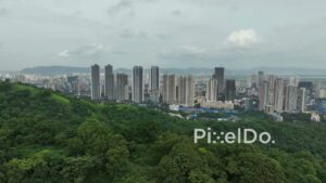
1 × ₹11,800.00 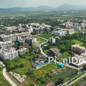 PD1057 - Aerial Drone Pan of Suburban Residential Township with Mountain Backdrop
1 × ₹8,850.00
PD1057 - Aerial Drone Pan of Suburban Residential Township with Mountain Backdrop
1 × ₹8,850.00  PD1012 - Aerial Orbit of Highway and Rural Village in Panvel Area
1 × ₹11,800.00
PD1012 - Aerial Orbit of Highway and Rural Village in Panvel Area
1 × ₹11,800.00 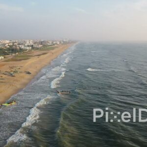 PD0933 - Drone Follows Fisherman Returning to Shore with the Day's Catch
1 × ₹14,160.00
PD0933 - Drone Follows Fisherman Returning to Shore with the Day's Catch
1 × ₹14,160.00  PD0936 - Drone Flies Over Ocean Towards a Coastal City
1 × ₹14,160.00
PD0936 - Drone Flies Over Ocean Towards a Coastal City
1 × ₹14,160.00 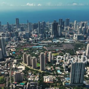 PD0323 - Expansive Aerial View of the Mumbai Skyline and the Arabian Sea
1 × ₹23,600.00
PD0323 - Expansive Aerial View of the Mumbai Skyline and the Arabian Sea
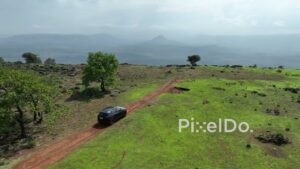
1 × ₹23,600.00  PD1045 - Aerial Drone Pan Over Rural Valley, Highway, and Mountains
1 × ₹8,850.00
PD1045 - Aerial Drone Pan Over Rural Valley, Highway, and Mountains
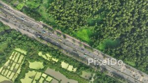
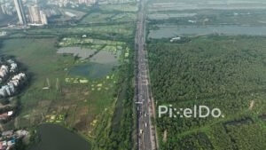
1 × ₹8,850.00  PD0963 - Aerial Drone Flight Over a Sprawling Urban Wetland
1 × ₹14,160.00
PD0963 - Aerial Drone Flight Over a Sprawling Urban Wetland
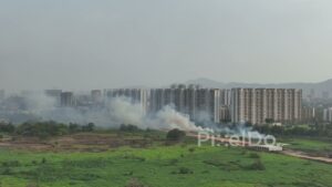
1 × ₹14,160.00  PD0125 - Smoke from a Fire Billowing Towards an Urban Cityscape in India
1 × ₹23,600.00
PD0125 - Smoke from a Fire Billowing Towards an Urban Cityscape in India
1 × ₹23,600.00 Subtotal: ₹130,980.00